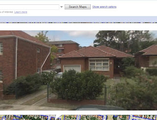
It's Google Street View, and it's just been released in Australia. It's Sydney at street level: you can navigate a virtual world of real photos, seamlessley stitched together. (The best place to start is an introduction here.)
Sydney was mapped out around November last year. Starting with what I know best, I went home first. I saw our house, car, and front garden (the jasmine bush is rather bigger now). Izoomed around our neighbourhood on a bright, sparsely-populated day. On the main road stood someone whose features weren't clear enough to discern, but who is doomed to stand in te middle of the road for the foreseeable future, waiting to cross the rest of the way. I saw clearly all the houses around, including a couple in the neighbourhood that have since been torn down, such as the one below which went a few days ago.

Apparently, the mapping process involved cars traversing Sydney with cameras mounted, taking photos every few metres. So you're following the road, but you can see all the buildings visible from the street by panning around at any point, as well as up, down, into the sky, onto the ground... One disconcerting aspect, however, is that the move forward along the road (in a series of jumps) depends on whether the photographers have covered the street both ways. You can be following a road for a while, consistently behind a particular set of cars, but then you can find yourself suddenly switched to the other side of the road - same orientation, but moving directly towards oncoming traffic. Then back again.
What use is it? Right now, it's just a toy to me. But it will probably become a useful navigational aid, for one. "Build it and they'll come" is apt here; it is so powerful that thousands of people's imaginations will surely find thousands of applications for it, particularly in embedding in other web pages and applications.
No comments:
Post a Comment